While I did enjoy the Tasman Glacier Heli Hike, I understand that not everyone will have the means to book one due to the cost.
If you think the price for the tour package is a bit high, then you might want to consider hiking the Blue Lakes and Tasman Glacier View Track instead (you can also read my article about the things you can do in Mount Cook).
It’s not really going to get you to the glacier but you’ll still be pretty close and you’ll even get to see the glacial lakes and ponds formed by the melting of the glacier.
I personally went on this track and it was quite an enjoyable hike.
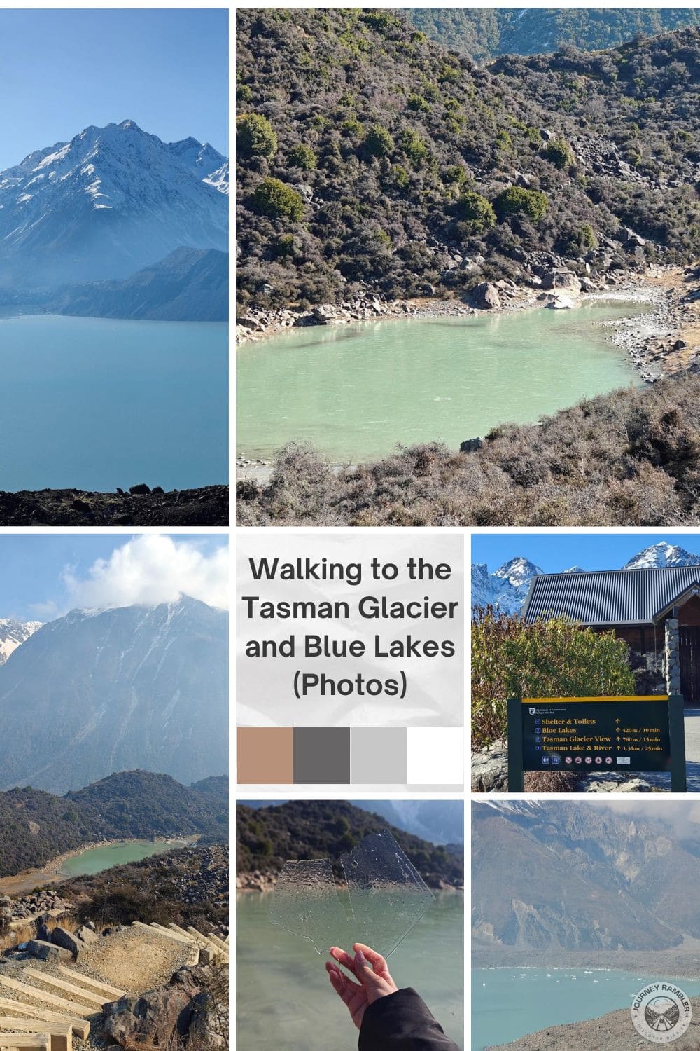
Tasman Glacier and Blue Lakes: Experience Tranquility in Nature
So there are a number of trails here that will bring you to different points around Tasman Lake. The trails are rather short compared to say the Hooker Valley Track and I think the longest (Tasman Lake and River) is around the same length as Castle Hill. For this outing, I decided to go with the Blue Lakes and Tasman Glacier View trails.
Since the trails are relatively short, you can realistically go through all of them in an hour and a half or two. As for the condition of the trails (or the trails that I went to), you’ll see in a while that they’re actually quite easy to walk on. There are inclines but they’re nowhere near as steep as the stairs at Castle Hill.
Mount Cook Hotel Recommendations Based on My Own Stay
🔹 Hermitage Hotel Mt Cook
🔹 Mt Cook Lodge and Motels
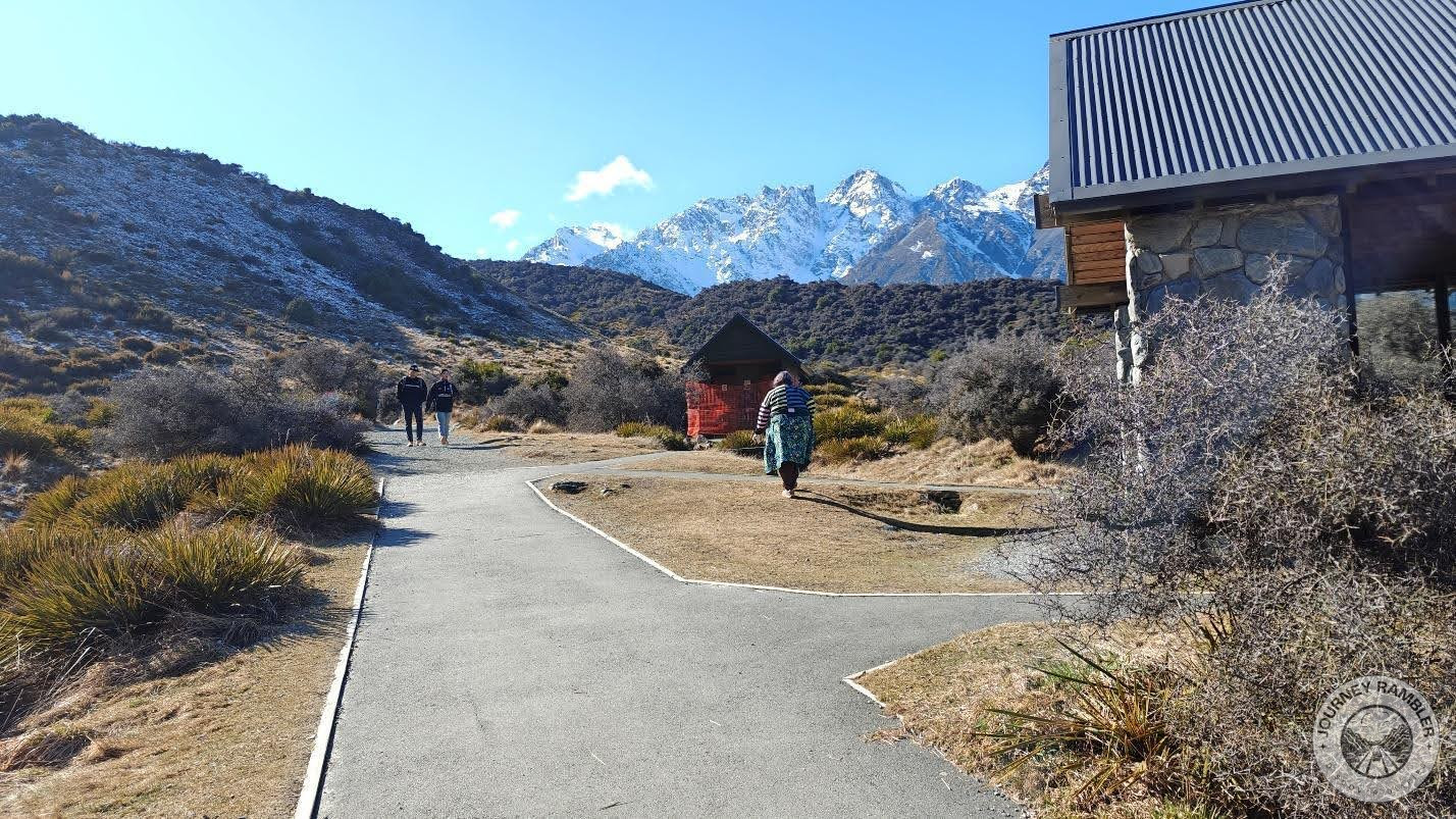
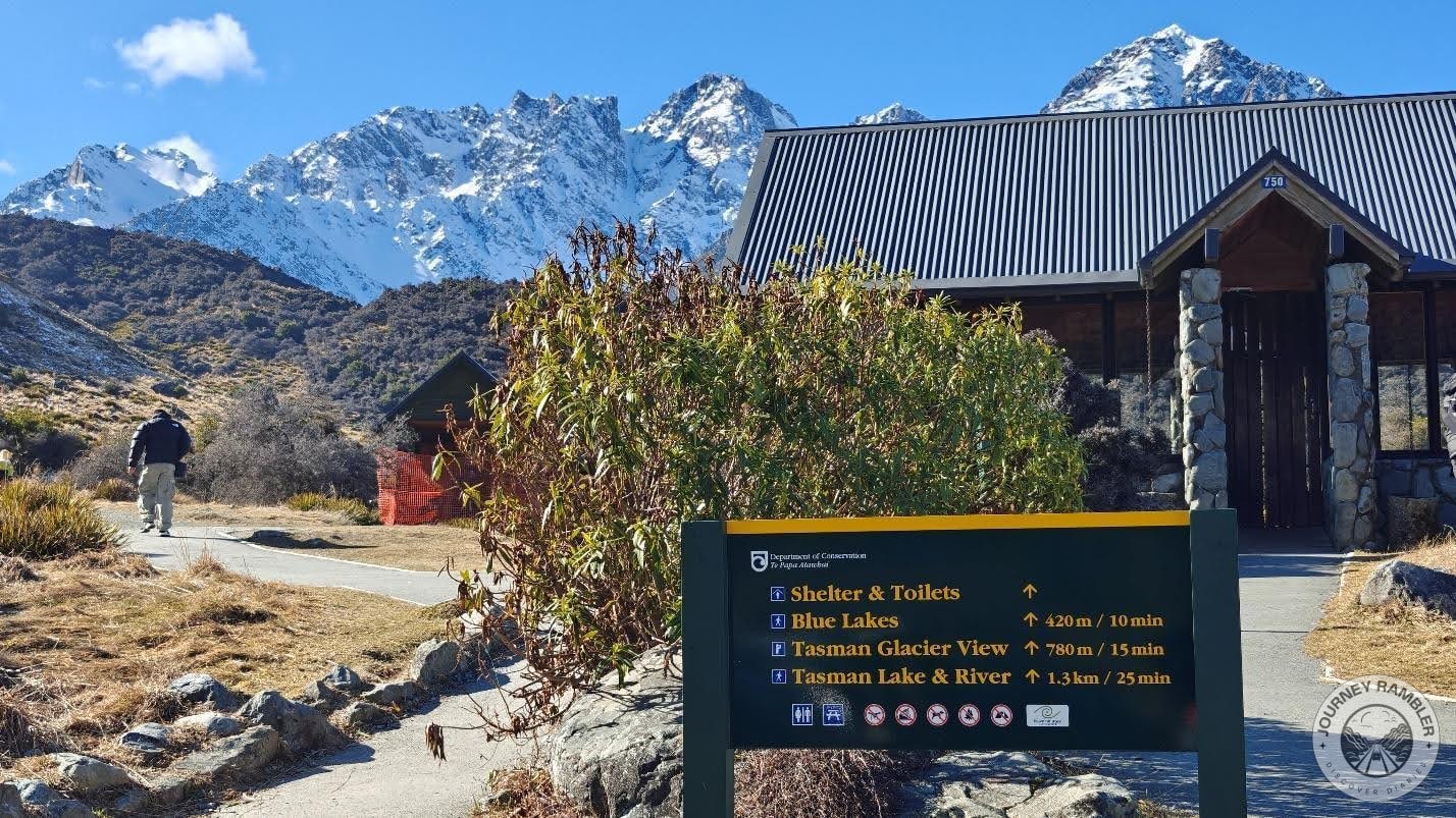
Here’s the start of the trail that I’ll be following for this hike. Now if you happen to find yourself here, I’d suggest you make use of the public toilet in this area first and do your business there. Unlike Hooker Valley Track, the trails here don’t have public toilets so if you need to go for number one or number two while you’re on them then you’ll need to get back here.
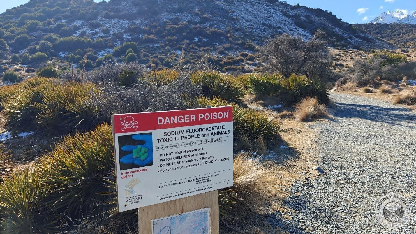
Another thing that you’ll need to be mindful of (as shown in this sign) are Sodium Fluoroacetate bait pods. These are mostly used to control the population of feral cats that pose a risk to the local wildlife. If I’m not mistaken there are also issues with rodents though it’s not as rampant as that of the feral cats problem.
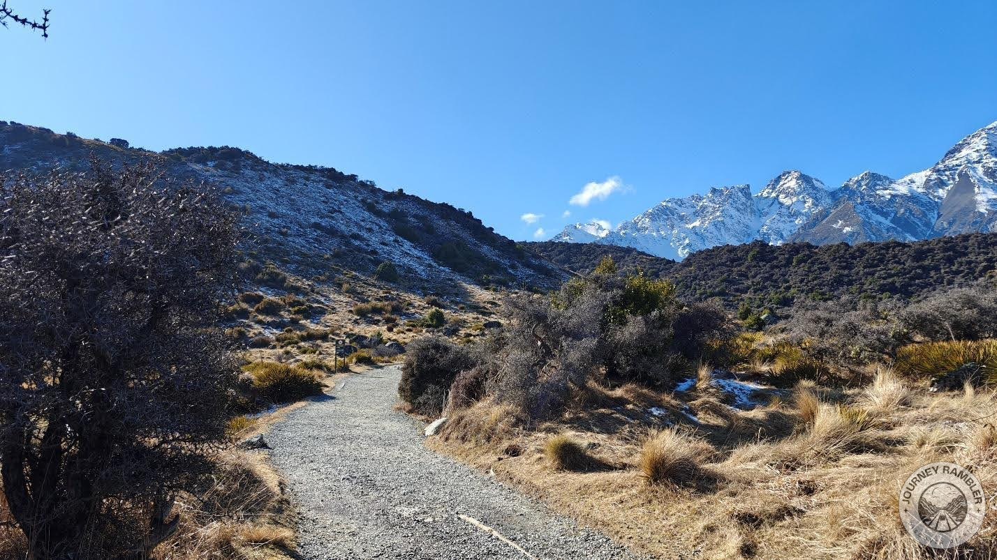
This is what the first couple of meters of the trail looks like. I will say, it was oddly calming to walk on here. Much like with my experience at Hooker Valley Track and Castle Hill, the presence of the mountains off in the distance again reminded me of the Lord of the Rings movies.
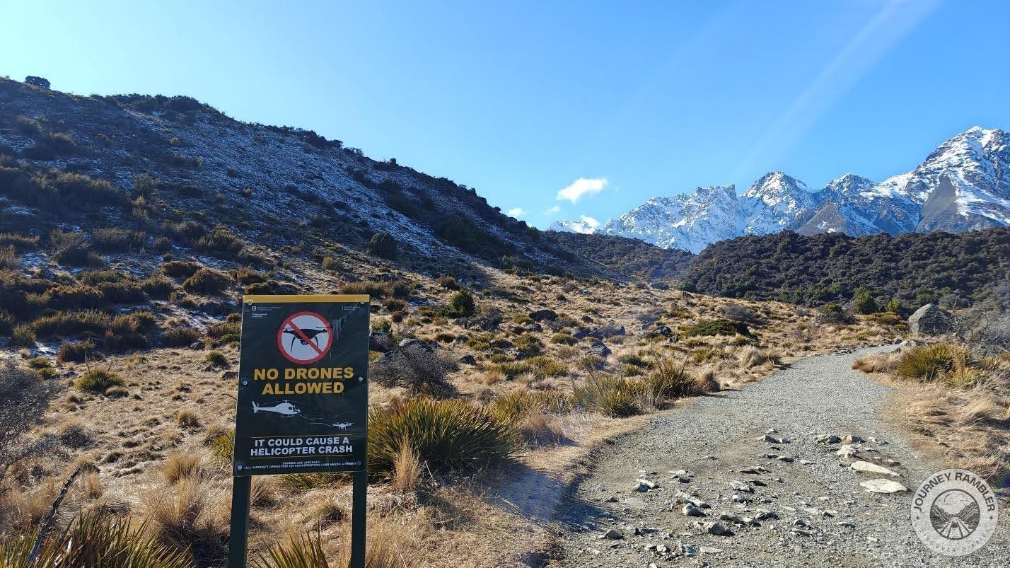
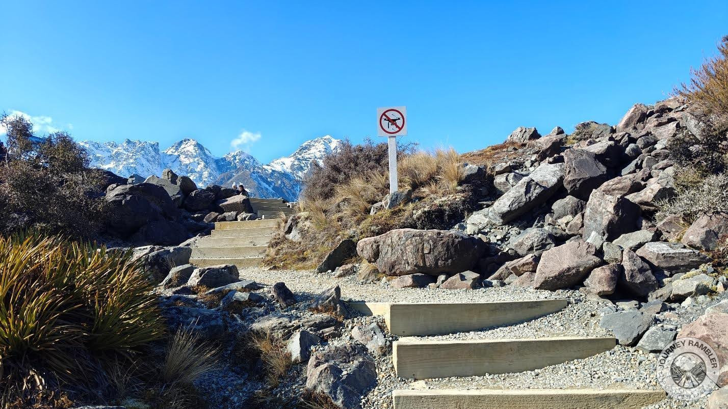
So this is an interesting sign that I came across while heading towards the Blue Lakes and Tasman Glacier View. The use of drones being restricted here is kind of understandable considering how often helicopters pass by here bringing passengers to and from the glacier. So if you plan to bring a drone when you visit New Zealand in the future, know that you won’t be able to bring it here.
Personally, I think that not being able to bring a drone here isn’t that big of a deal. Drones have kind of become obnoxious and for some reason, I just can’t seem to bear the noise they make. Also, I think they take away from the appeal of the whole trail and the alternate view of the mountains in the Southern Alps that you’ll find here.
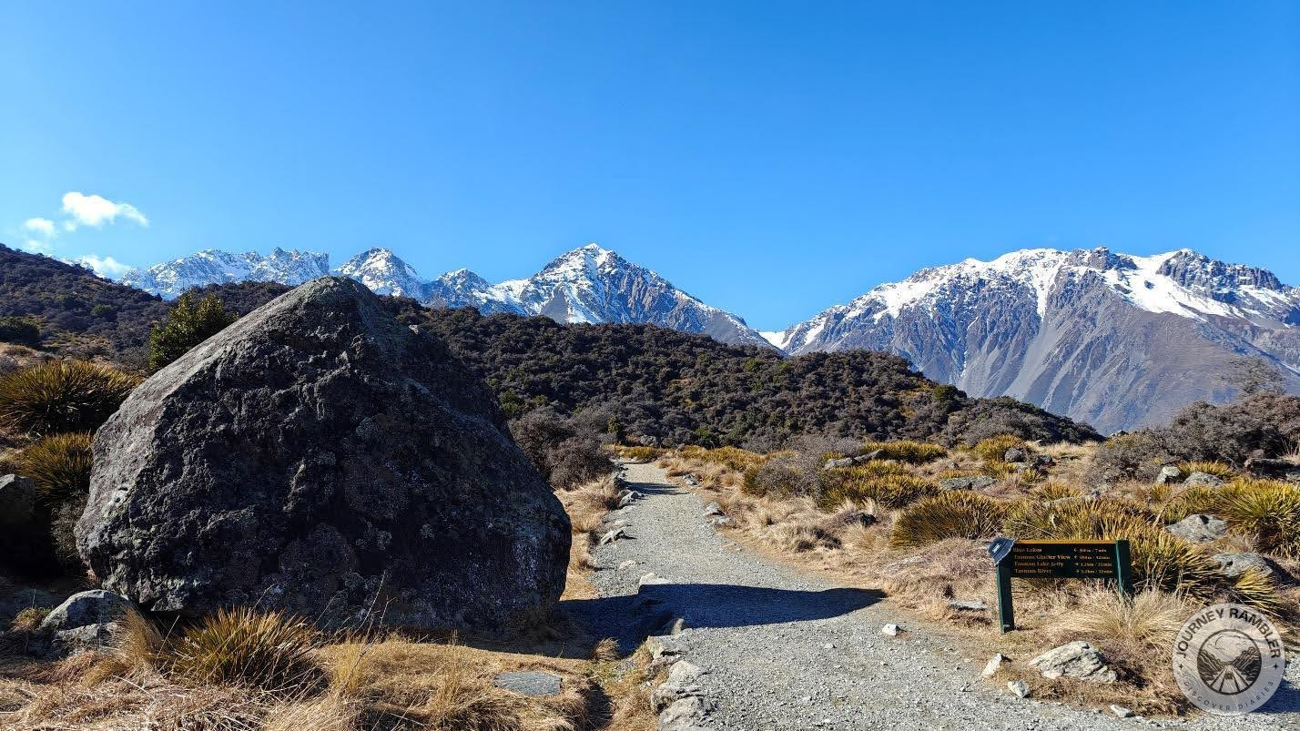
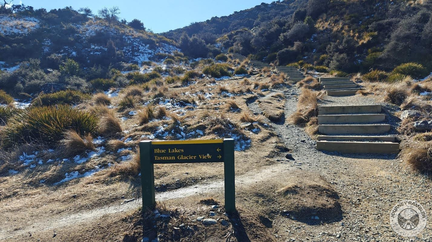
So this is where the beginning section of the trail splits. It’s pretty hard to miss thanks to this huge boulder. Also, I think this is where the views start to really get good. If you have a really nice camera then you’ll love taking shots of the mountains in the background.
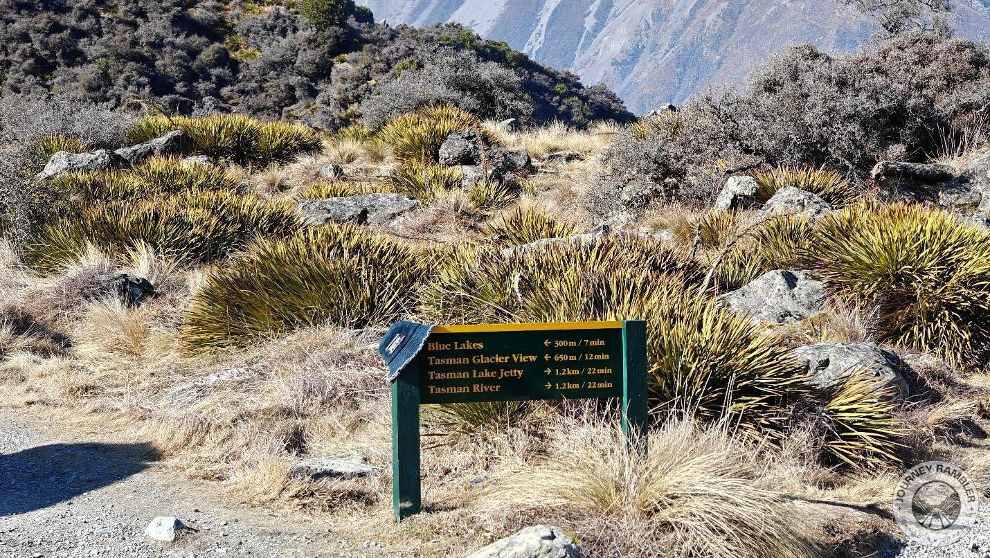
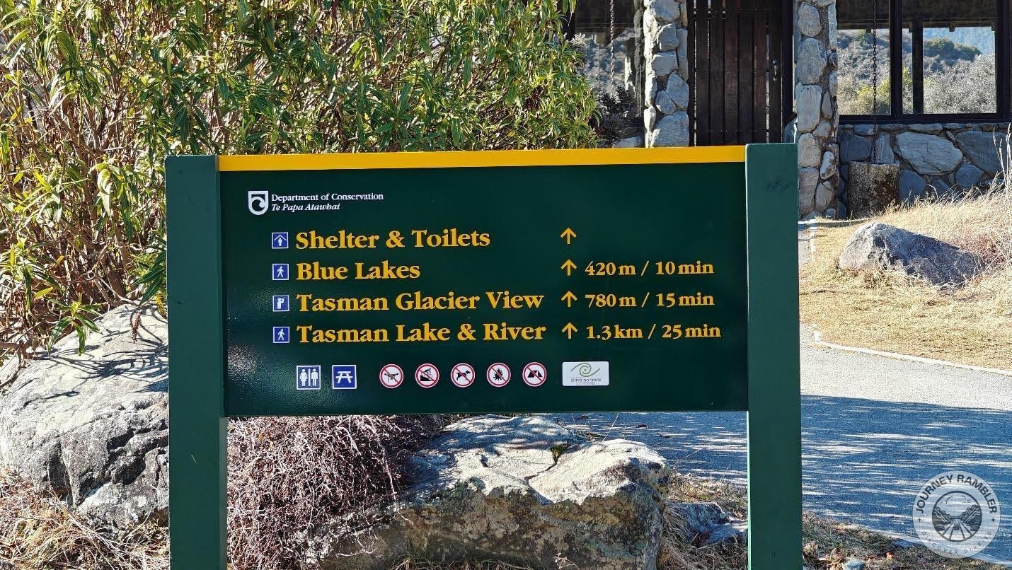
Just opposite the boulder is a sign with directions pointing to the notable attractions/destinations that you’ll find at the end of each trail. Like I said in the beginning, for this writeup I chose to go to the left route which would lead me to the Blue Lakes and the Tasman Glacier View. As you can see, both are much closer as opposed to the right trail which would’ve lead me to the Tasman Lake Jetty and Tasman River.
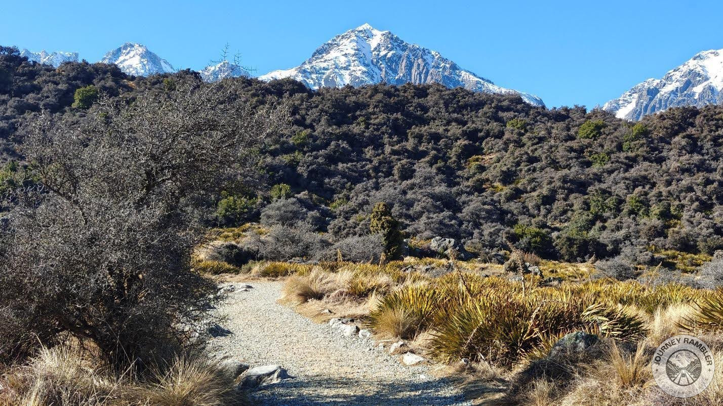
The trail looks kind of drab right now because it is winter. It does get a little better and greener during the summer season though so if you think the scenery here looks dull then you might want to come here earlier in the year. I personally like how this all looks and I just think there’s a certain charm to what most people might call a drab and gray scenery.
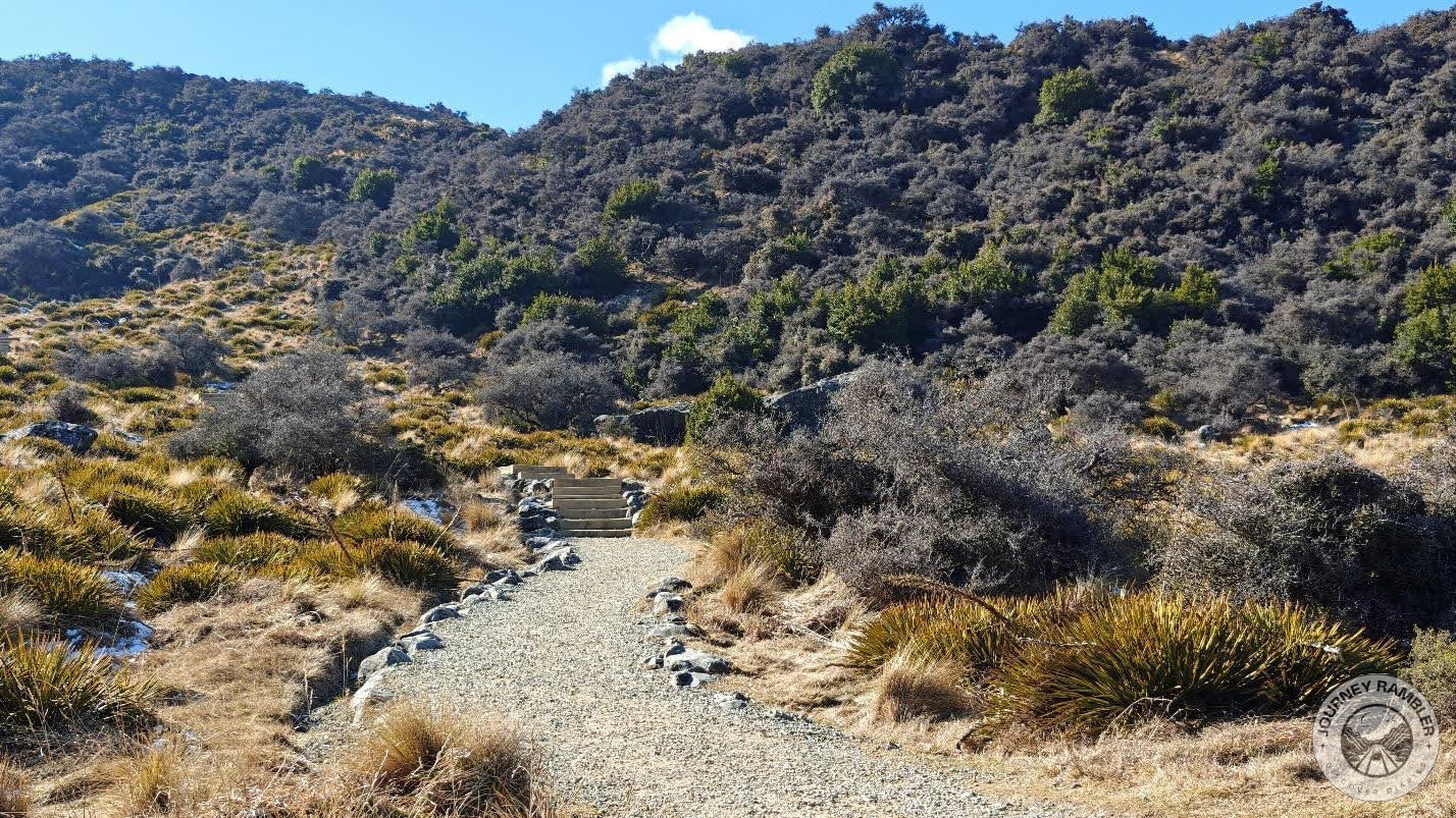
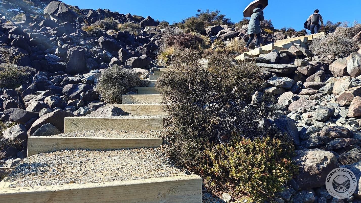
Once you reach the end of the path from earlier, you’re then going to turn left and you’ll find this set of stairs. This section of the path prior to the stairs was honestly pretty uneventful. At this point, I was thinking more of the views awaiting me once I managed to climb up the stairs.
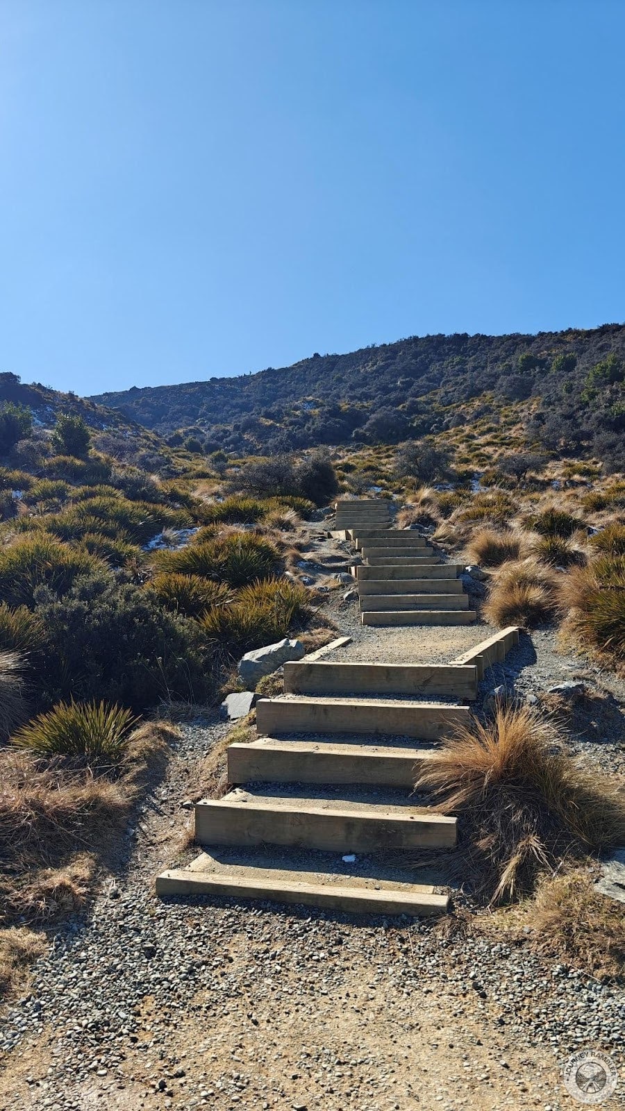
Speaking of stairs, here’s what they look like up close. They’re nothing special and really they’re pretty similar to the ones that I’d climbed up in Hooker Valley and Castle Hill. If you’re wondering, yes, they’re relatively easy to climb up on though take note that it is still going to be a long climb. I think if you’re used to hiking you probably won’t have much of an issue climbing up and down these stairs.
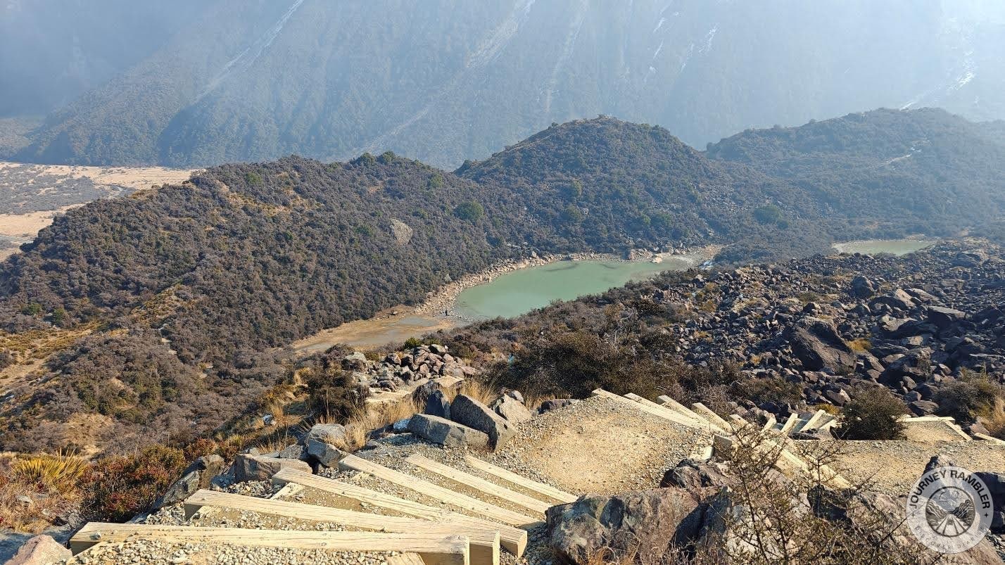
Here’s the junction that I was talking about. On the left is the trail going to the Blue Lakes while just ahead is another set of stairs leading up to where you could view the glacier and the lake that it feeds into. Now, once you get here you might want to take a rest first.
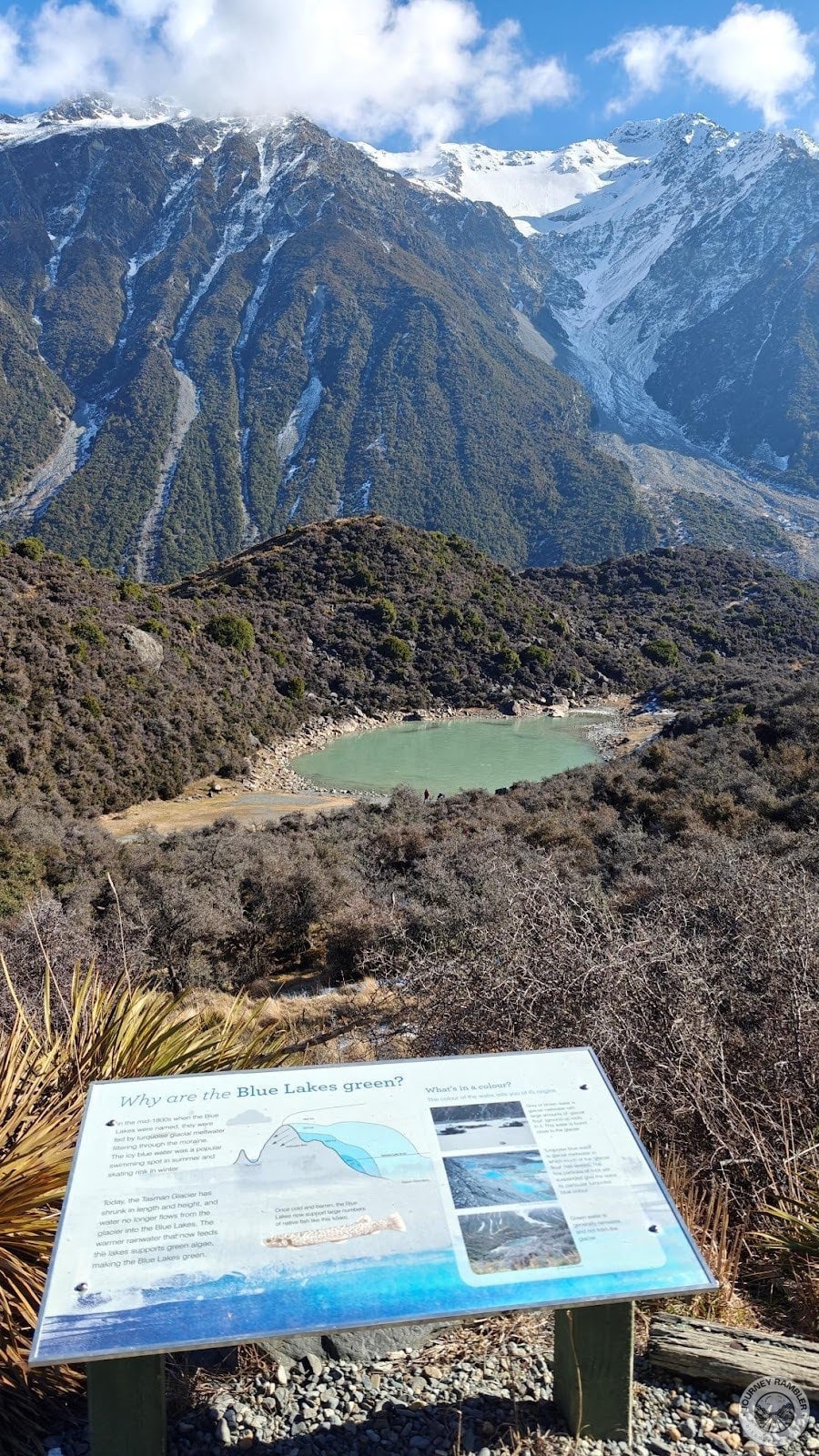
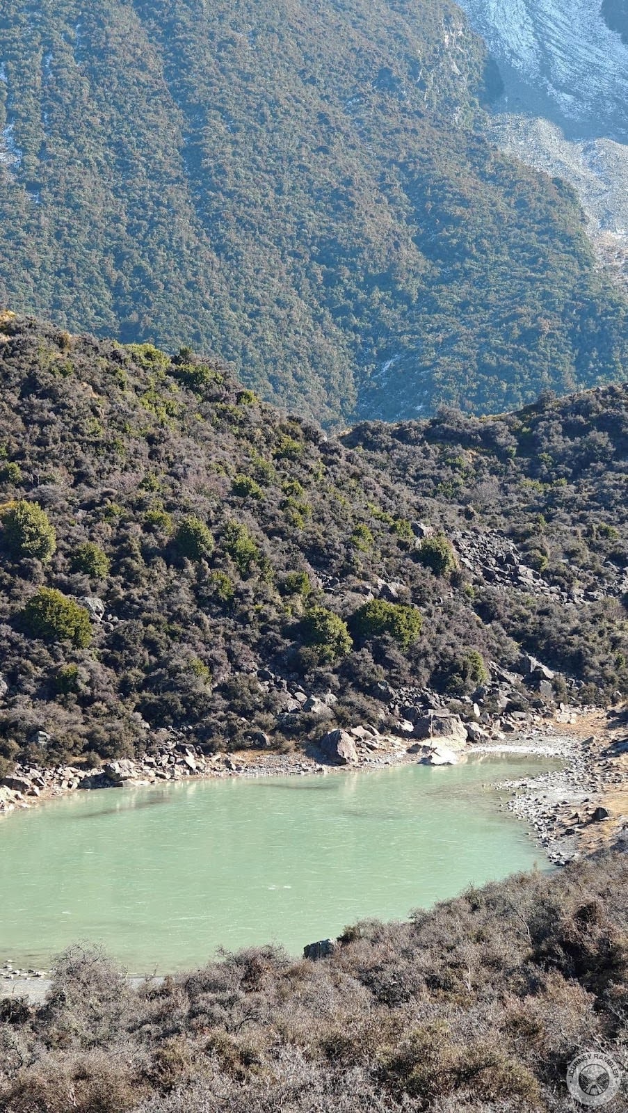
Thankfully, there’s a lookout here where you can then view the Blue Lakes. Additionally, there’s an infographic explaining why the color of the Blue Lakes is green and not blue. It’s actually an interesting read and I highly suggest checking it out yourself once you get here.
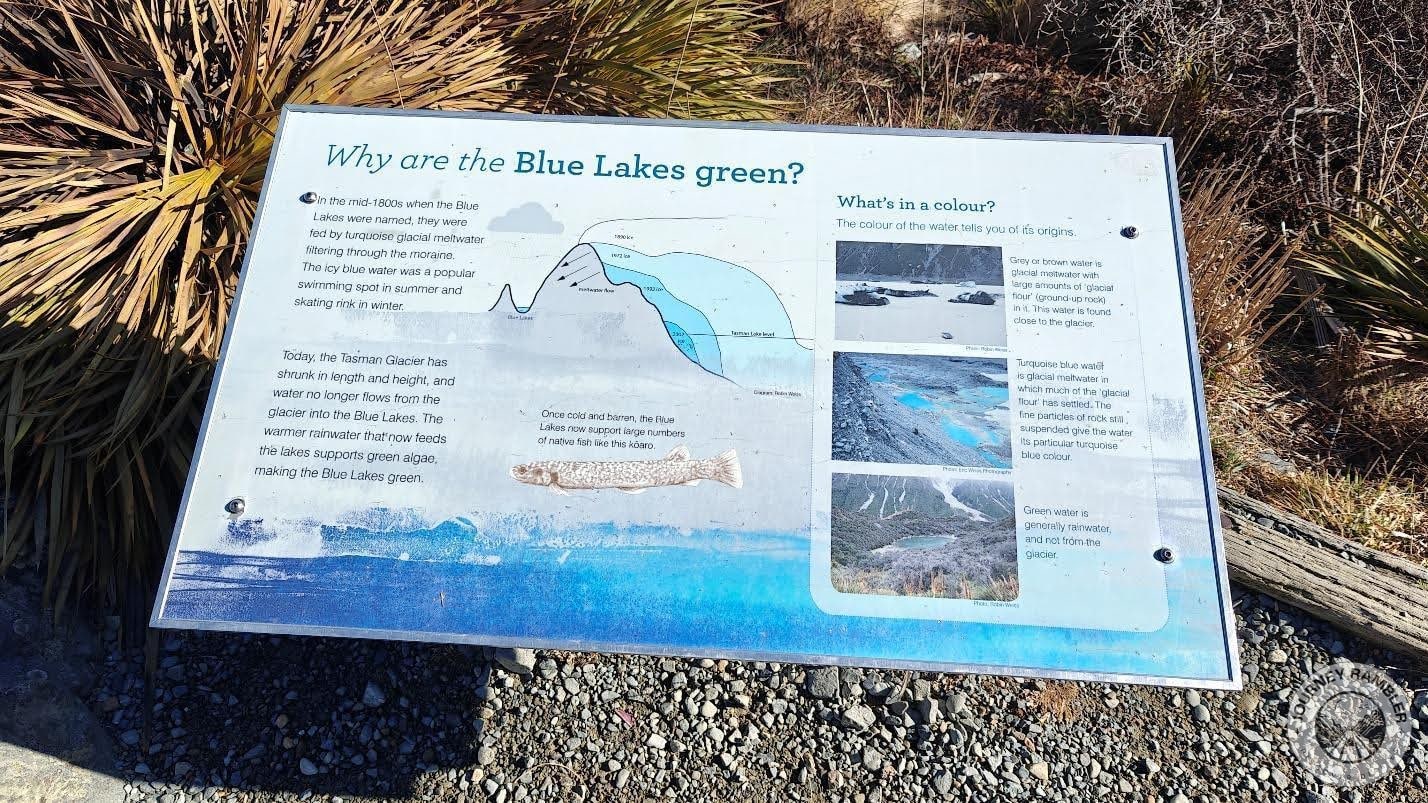
The infographic delves into the history of the Blue Lakes as well as the phenomena that resulted in it forming. The particular lake you see here in this lookout is green because its water is from accumulated rainwater rather than glacial melt. The Tasman Lake on the other hand looks grey-ish thanks to its high concentration of dust/ground up rock.
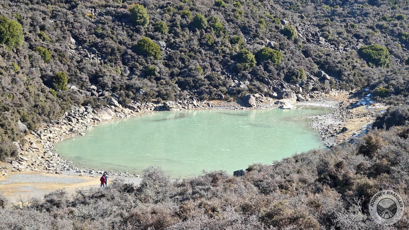
Just as I was reading the infographic, I noticed a couple of visitors going near this lake’s edge. Initially, I just wanted to head up straight to the top to get to the Tasman Glacier lookout deck. My curiosity got the better of me though and I decided to head down and see what the people there were busy looking at.
The trail going to the lake is a little bumpy and uneven but still very walkable. I think its main draw though is the view of the lake (really, its size makes it more like a pond) that it affords you. If you’ve been following my travels, you’d know how I enjoy being near bodies of water and this time isn’t any different.
Once I got close I immediately understood why the people were here earlier. The water was just so tranquil and combined with the relative silence, made this a great place for reflection. While it might seem enticing, I don’t think you can swim here though the infographic did say this used to be a popular swimming spot.
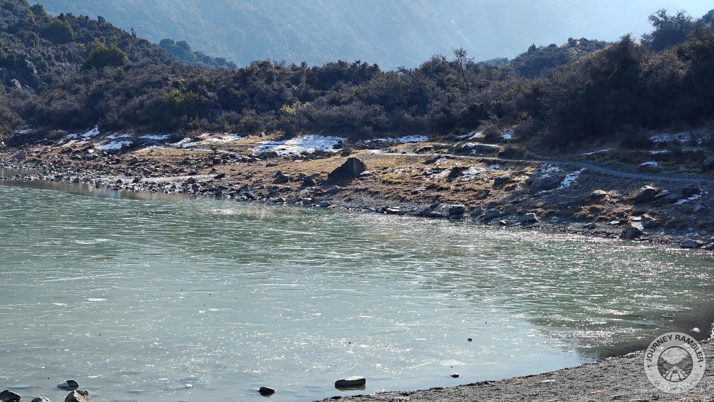
It wasn’t evident earlier, but this place actually gets some snow as well. If you swam here when I took this picture then I guarantee you’d be sniffing your nose the following day at best. At worst, you’d probably end up with hypothermia. I did read that the water does get warmer during the summer so maybe you could schedule your trip during that season if you really want to take a dip here.
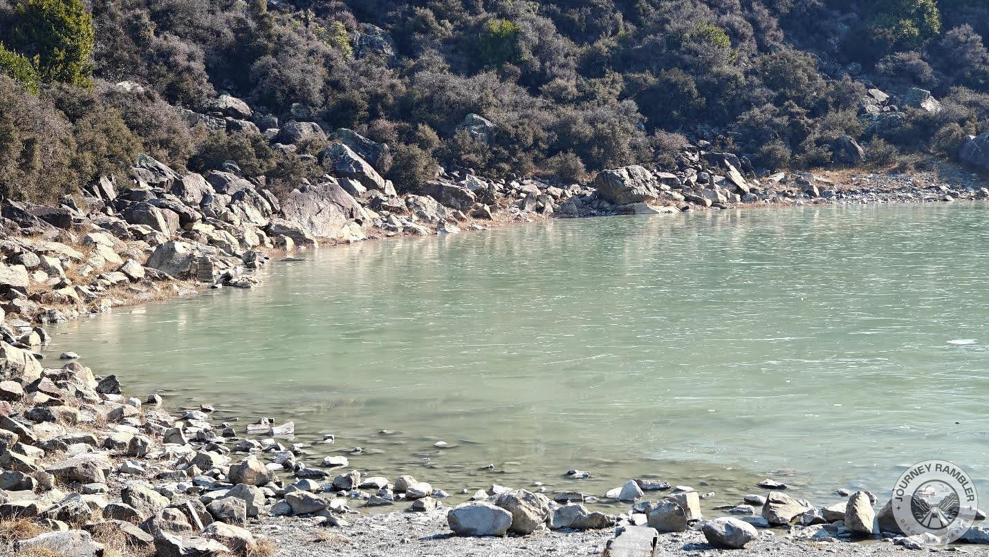
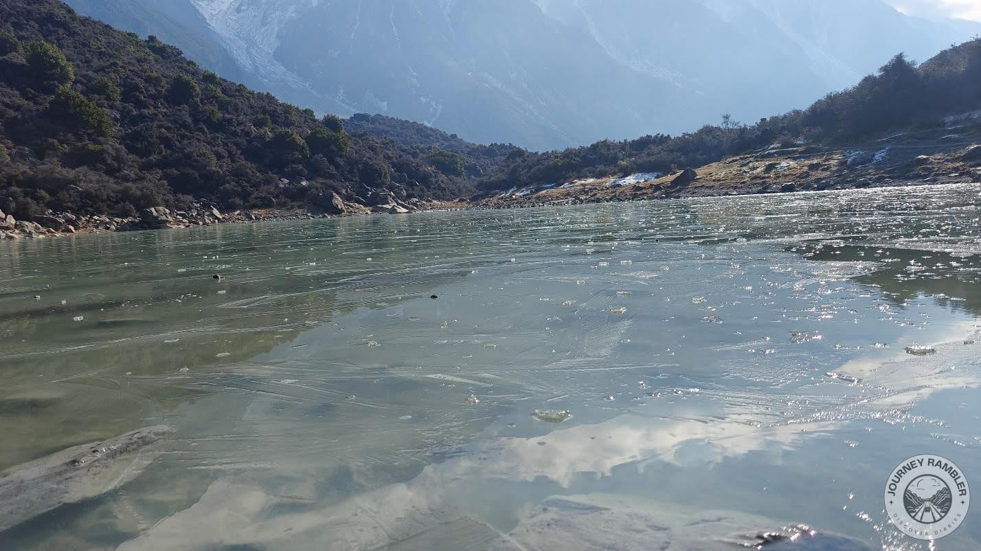
It’s not quite clear but if you look at the opposite end of the lake, you can see what looks to be some ice/snow on its edge. On the water itself, you can actually see pieces of ice floating. As for potability, I wouldn’t risk drinking any of this water.
So I said earlier that the green water here is caused by the rainwater. While that’s technically correct, there’s actually a more in-depth answer. Unlike glacial melt, rainwater has lots of nutrients and doesn’t have high levels of ultraviolet radiation. This makes it an ideal medium for algal growth which in turn gives it the greenish color.
The green-ish color of the lake actually isn’t as evident when you’re close to it. In fact, the water in its banks is crystal clear. I could imagine this being a really nice place to cool off your feet especially if you’ve been walking around this area during the summer.
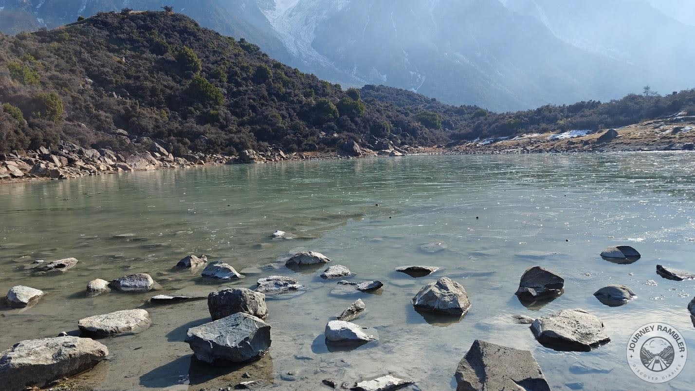
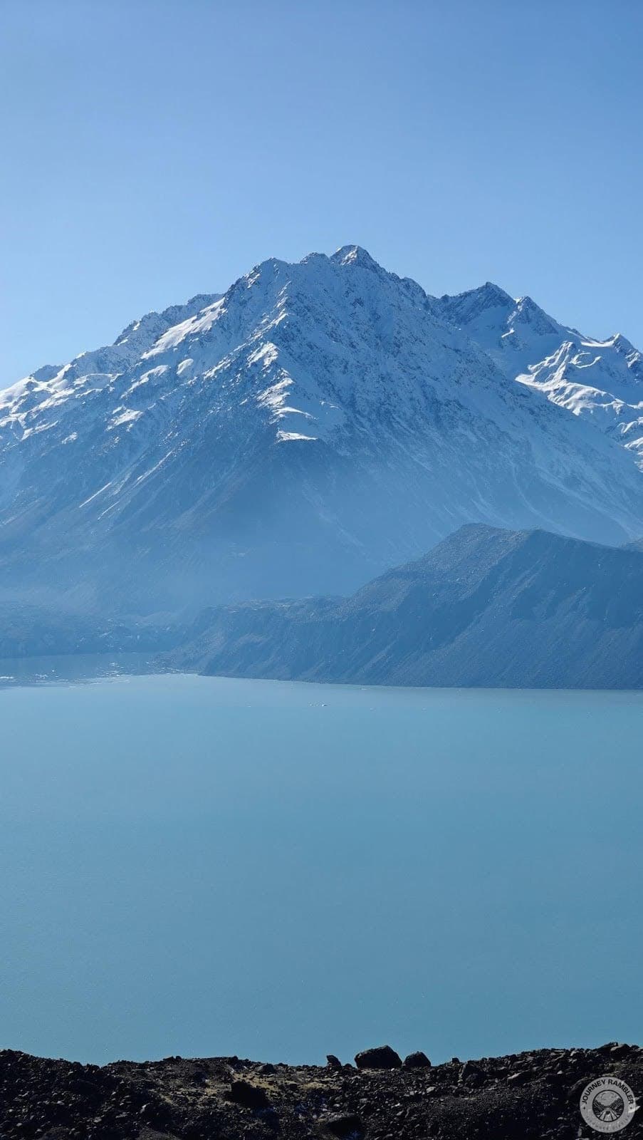
Aside from the lake, perhaps the most notable feature of this area is the view. The towering mountains in the background honestly made me feel quite small. There’s this sense of grandeur and wonder here that is similar in a lot of ways to the views that I came across in my Hooker Valley Track and Castle Hill hikes.
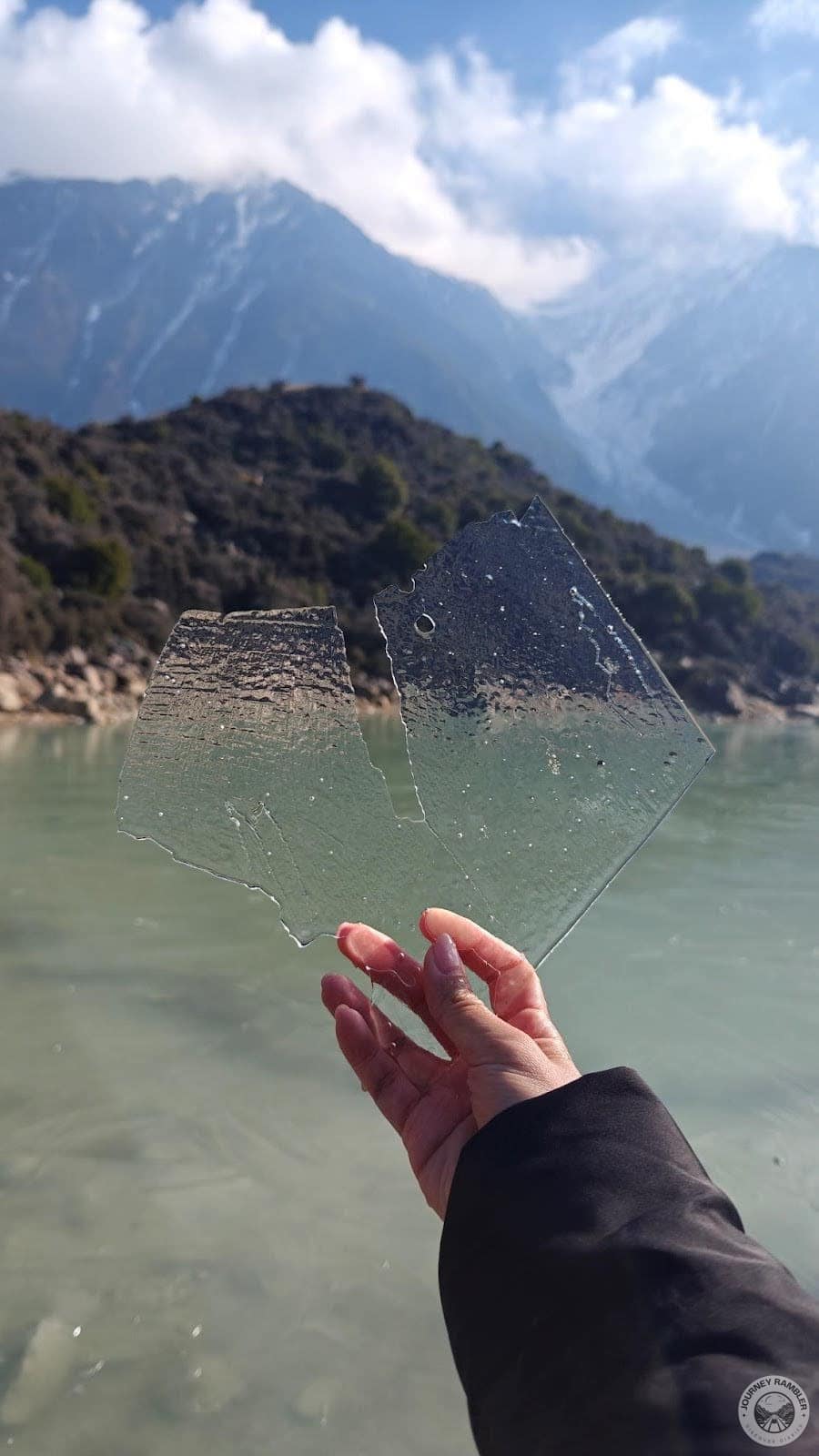
I tried dipping my hands in the waters of the lake and was pleasantly surprised to pick up this piece of ice. So if you happen to be doubting me, this is my most compelling argument for not swimming in this body of water at this time of the year. Seriously, you’ll find there are plenty of nicer and warmer places to swim if you come to NZ in the summer.
In this angle, you can see other pieces of ice floating on the water’s surface. I’ve read earlier in the infographic that people used to skate here when the water was frozen over during the winter season. Just imagine how awesome of an experience skating with the mountains serving as your backdrop would have been.
And with this picture, my short stint here at the lake ended. It was honestly a decent stopover and I personally think this place is a little underrated. Like most people on social media who’ve posted about the trails here seldom feature this area. If you do end up visiting, I’d highly suggest you go out of your way and check out what this area has to offer.
After that Blue Lakes visit, I went on back to the junction and continued climbing up the stairs. I’d had a lot of practice in Japan and China so I didn’t have much of an issue with the climb. That said, I do understand that not a lot of people might have the same experience and fitness level as me. If you’re one of these people, I’d highly suggest you take your time and not hurry with the climb.
Remember, there’s no race to the top here. By taking your time, you not only conserve your energy but you also get to better appreciate the views. This is going to be especially true for much older hikers who might not have the spring to their step that younger people might have.
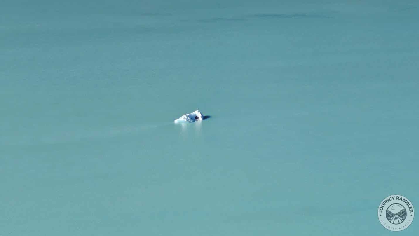
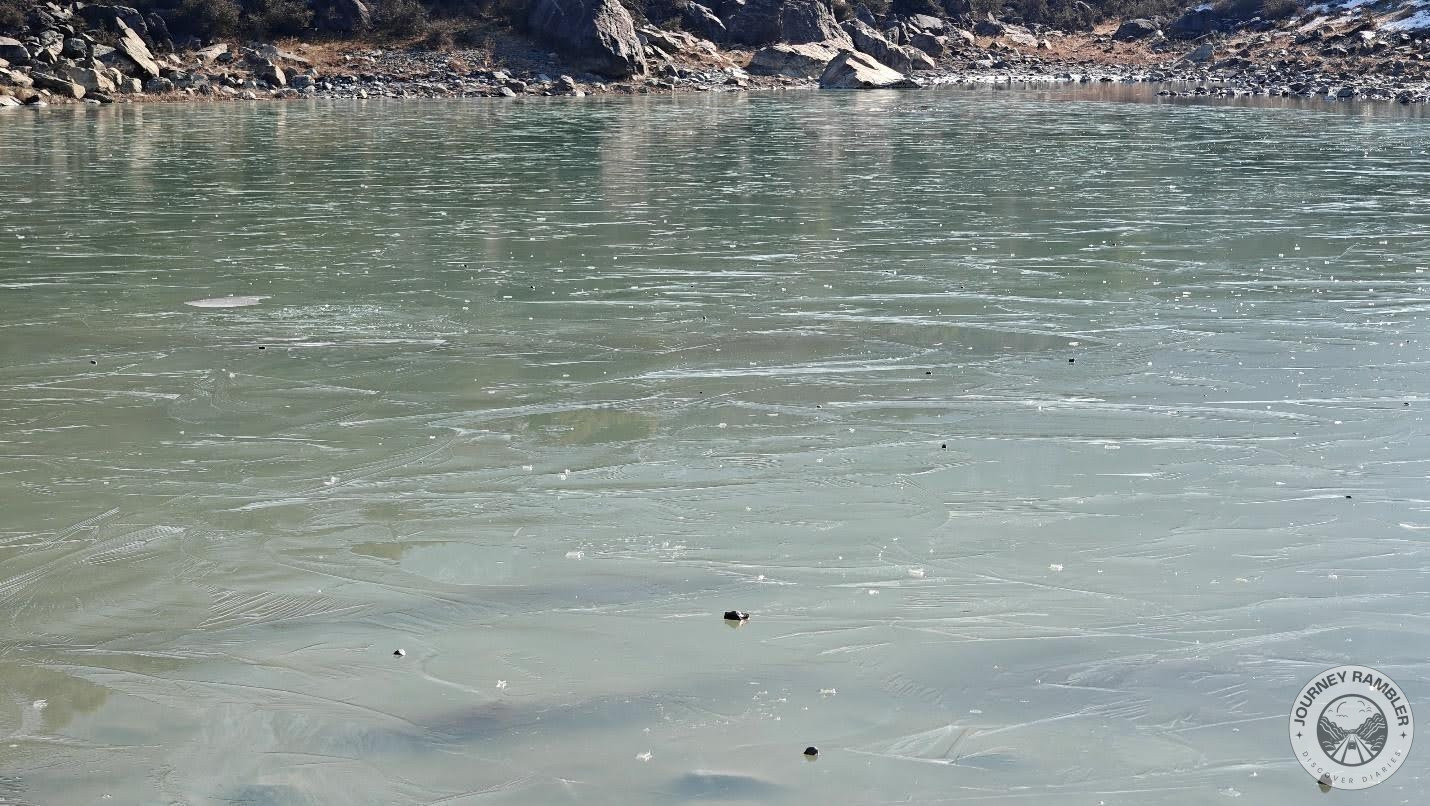
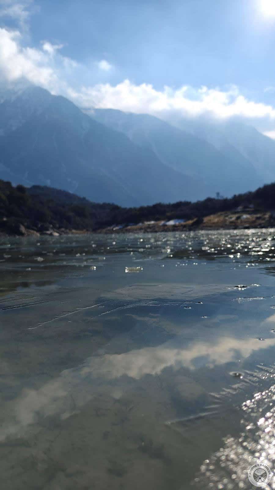
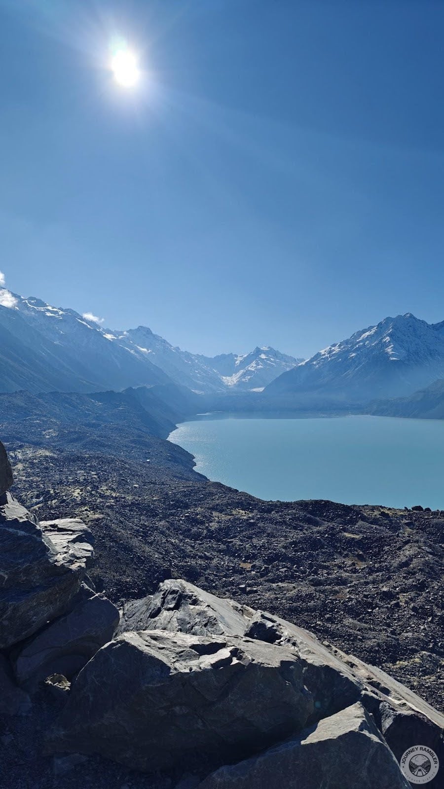
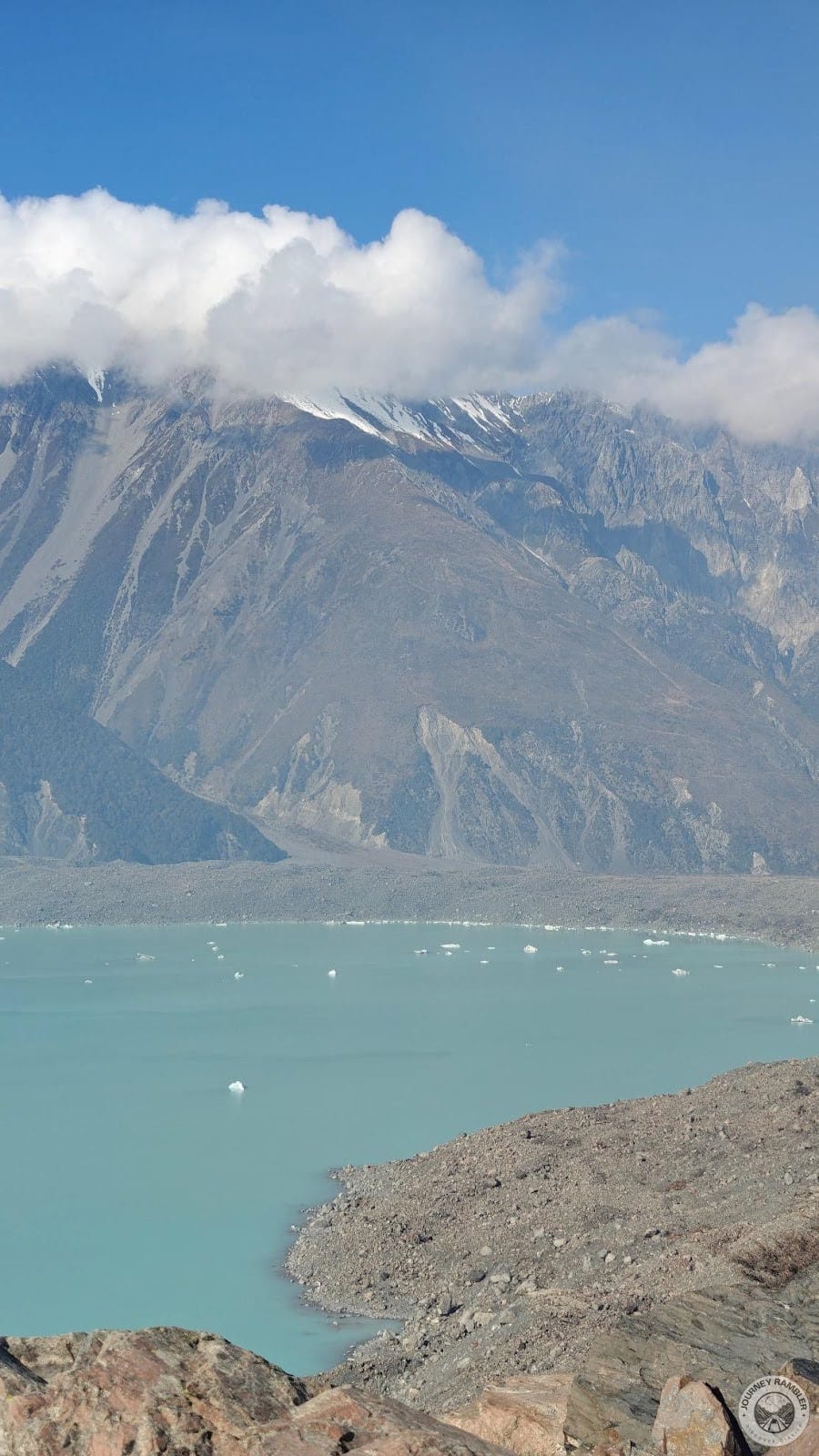
Here’s one of the first things I saw once I got to the top of the Tasman Glacier View. If you don’t go to the other trail then this is quite possibly what you’re going to see here too. This is basically the surface of the lake with a piece of ice poking through it. I honestly thought the color was cool now that I got to see a little closer.
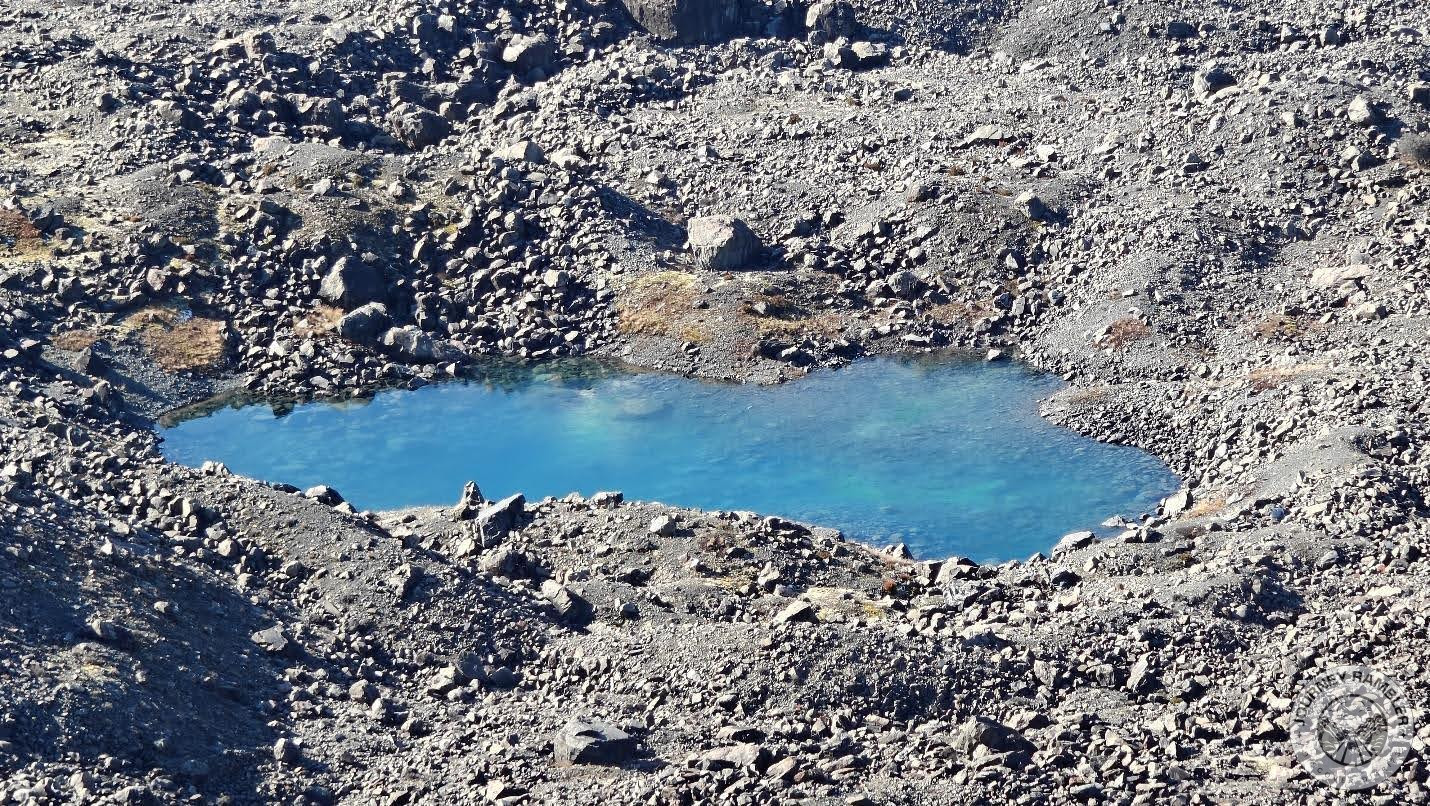
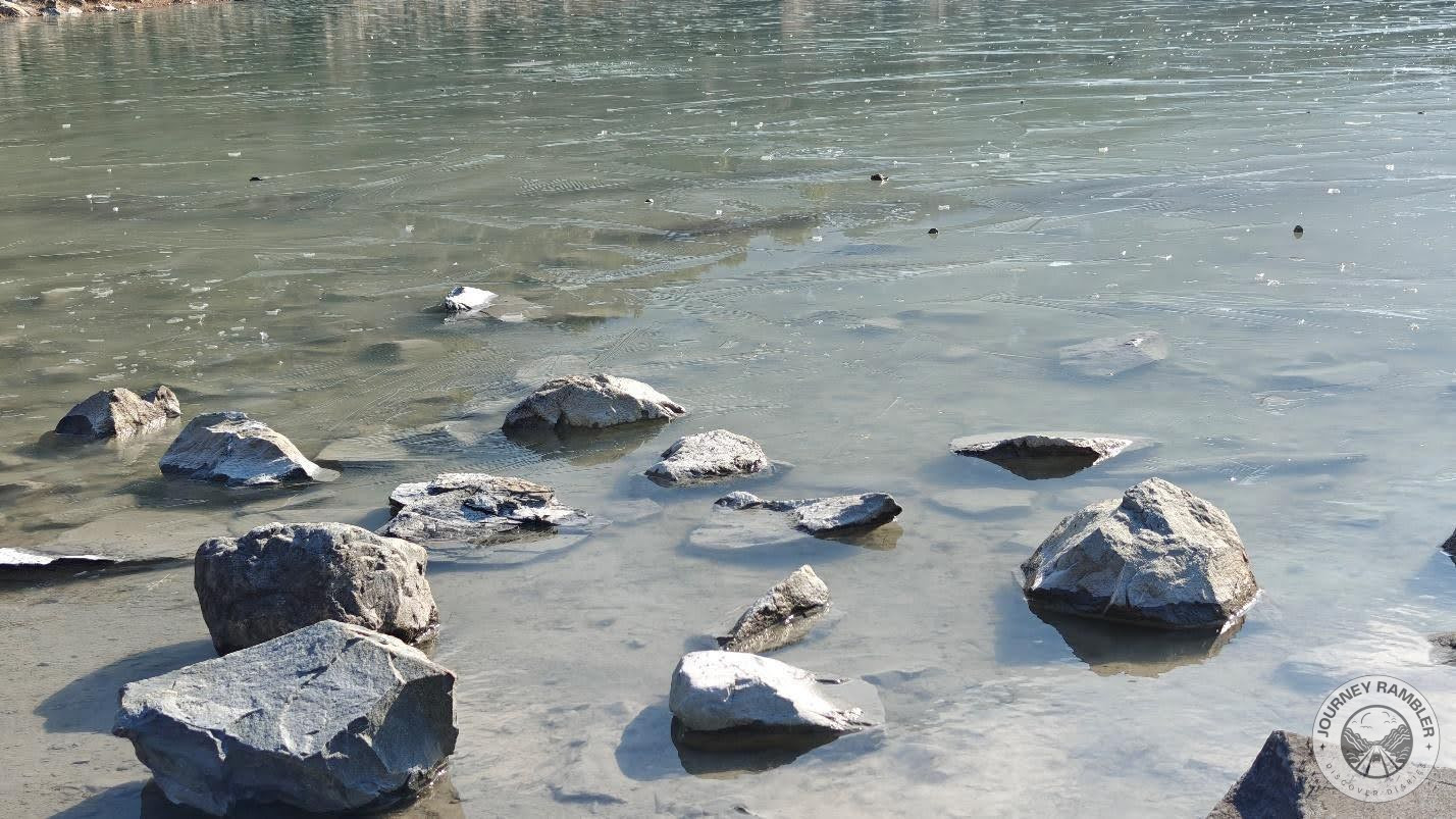
I also noticed this small puddle which seemingly looked like a miniature version of Tasman Lake. This was directly in front of the view deck just before the edge of the lake which made it really easy to spot. I’m not too sure if this was a naturally occurring puddle or one that was made to look like the lake’s miniature.
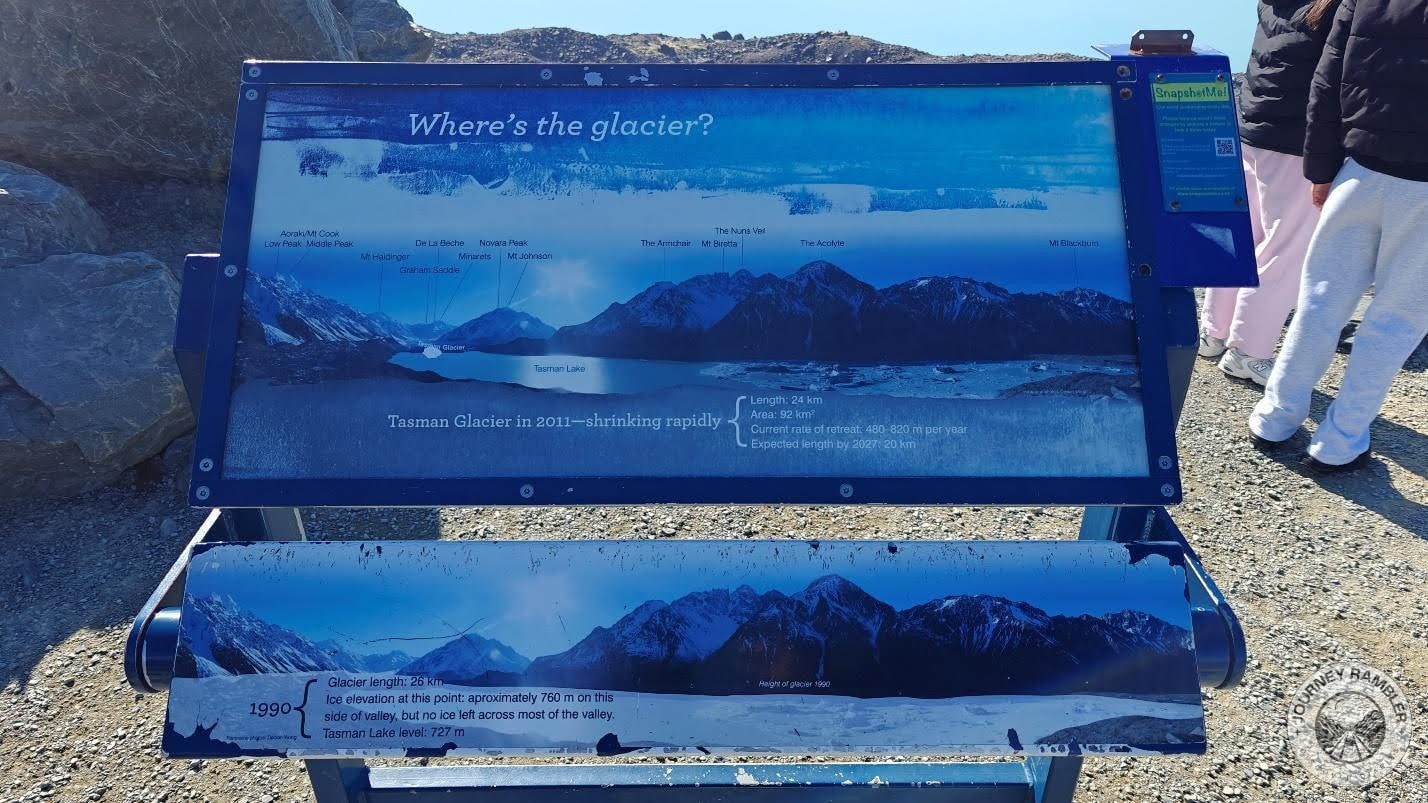
Similar to the Blue Lakes earlier, this Tasman Glacier View area also has a sign with information about the lake, the glacier, and even the surrounding mountains. What struck me the most about this though was the pictures of the glacier in 1990 and in 2011. It’s actually wild to see how drastically different these two images of the same place are!
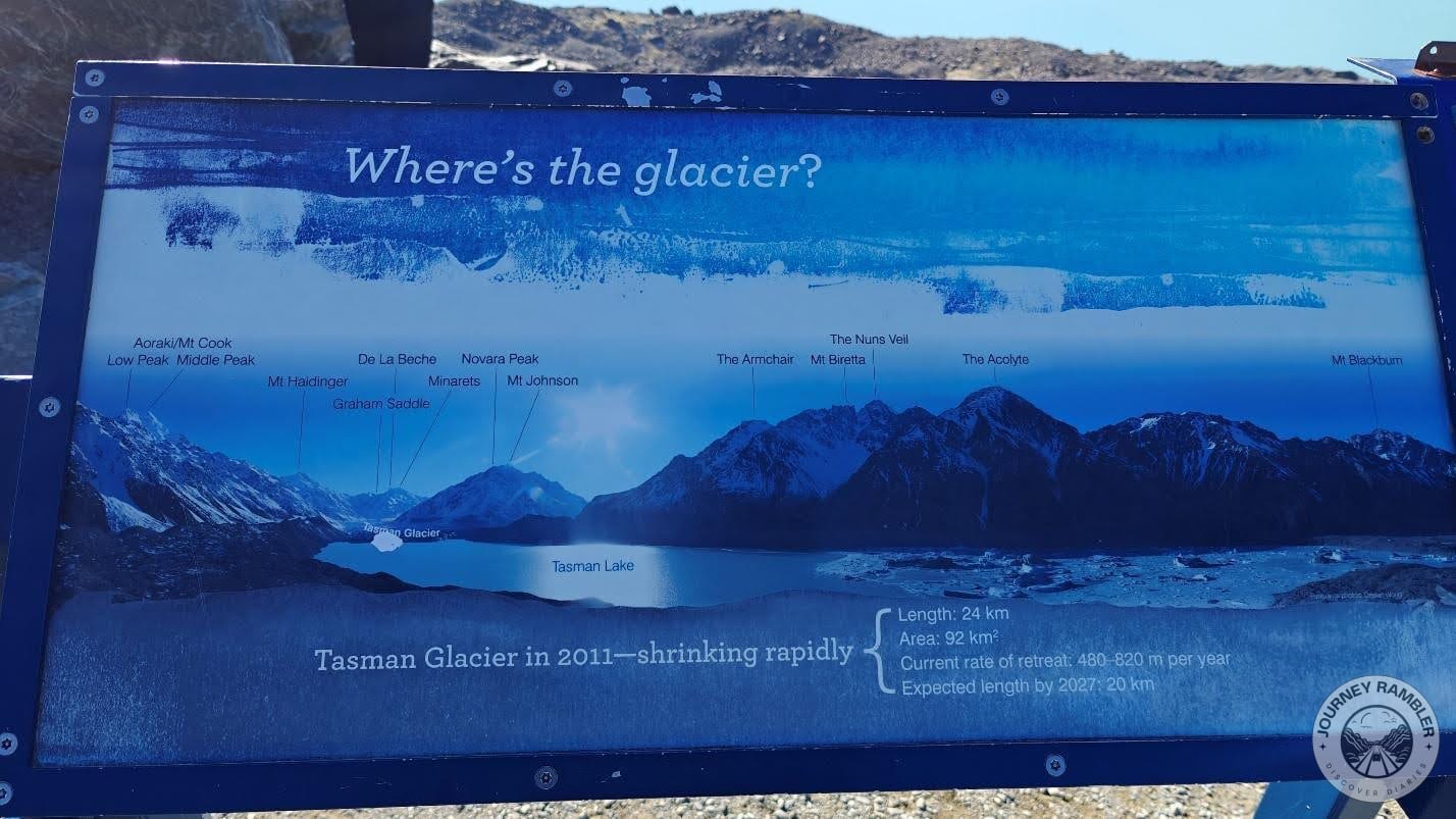
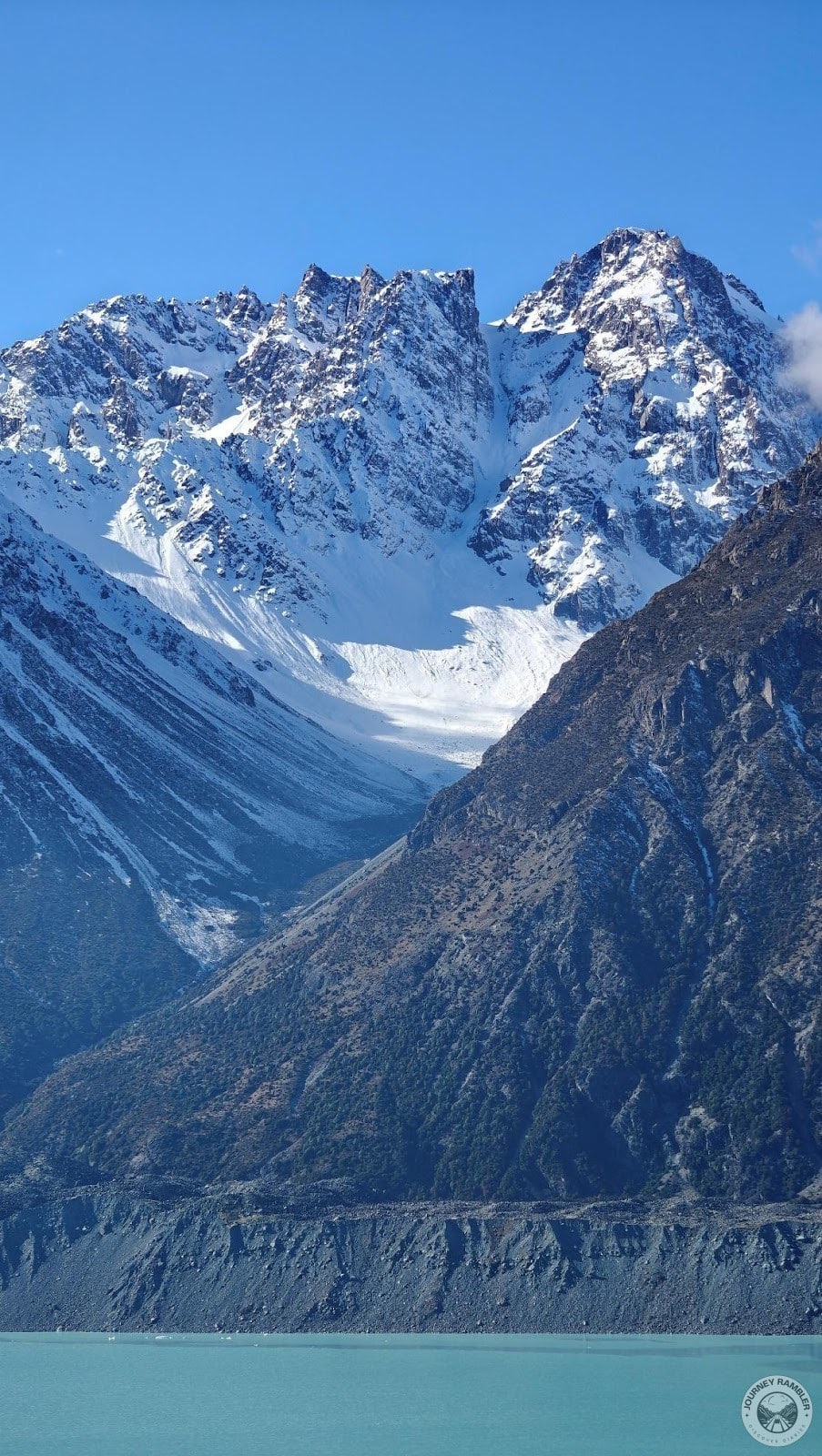
I’d already know the Tasman Glacier was large. What surprised me was just how large it was nearly three decades ago. Seriously, if you were at this exact spot in the 90s, you’d have no need to get a heli hike tour package since you can probably just walk a couple of meters and you’d be on the glacier. Now all that’s left of that once magnificent natural wonder is Tasman Lake.
You can see just how far the Tasman Glacier has retreated even when compared to the 2011 photo. Don’t get me wrong, the place still looks amazing up to this day but imagine just how magnificent it was prior to this. On a related note, it’s also kind of sad that what’s happened to the glacier is a direct consequence of our actions as a species.
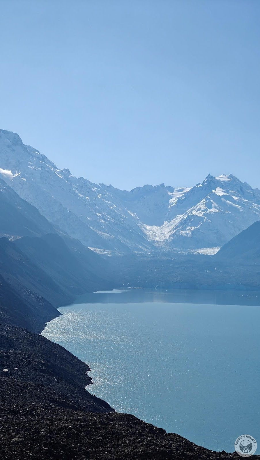
This is what the glacier looks like now. At least, what’s left of it that is. Make no mistake, the glacier is still around. It’s just that its main mass is now concentrated near the mountains. If you read my writeup of the Tasman Glacier Heli Hike, you’ll see that it still is sizable though definitely not as large or as long as it once was.
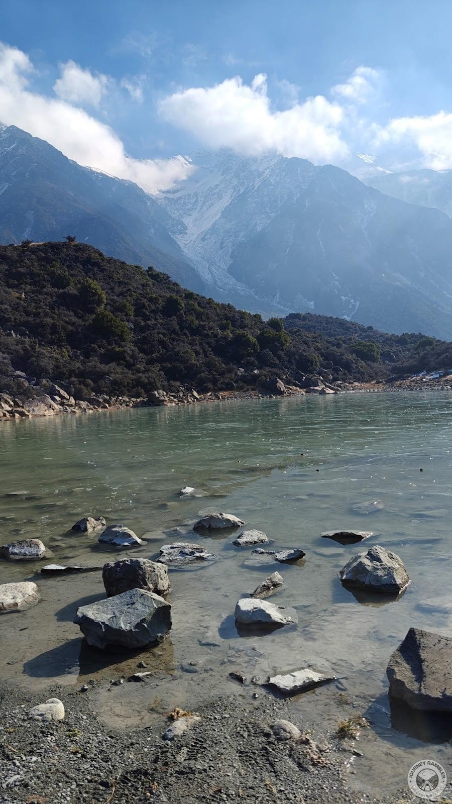
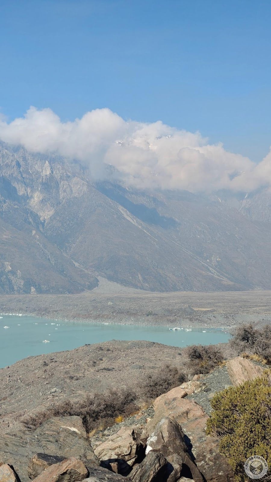
One thing I liked about the scenery here is the presence of this fog-like atmosphere that seems to permeate the area surrounding/near the mountains and the glacier. If I’m not mistaken, this is the advection fog that occurs when warm air comes into contact with the snow and ice. Don’t know what advection fog is? I sort of explained what this is when I wrote about my Tasman Glacier Heli Hike experience so make sure to read that if you want to know more about this phenomenon.
I know I’ve been talking about the Lord of the Rings for a large number of my New Zealand articles but there’s actually one other entertainment series that just recently reminded me of the landscapes and views here. Both Hercules: The Legendary Journeys and Xena: Warrior Princess were also shot here in New Zealand and those were two TV shows that I fondly remember watching. Coincidentally, Lucy Lawless, the actress who played Xena, also happens to be a New Zealand native.
Here’s exactly where the glacier is as of now. It’s a bit far from where our helicopters landed during the heli hike tour that I mentioned earlier. I doubt tour operators would have their pilots land here since that’s where all the glacial melt is coming from.
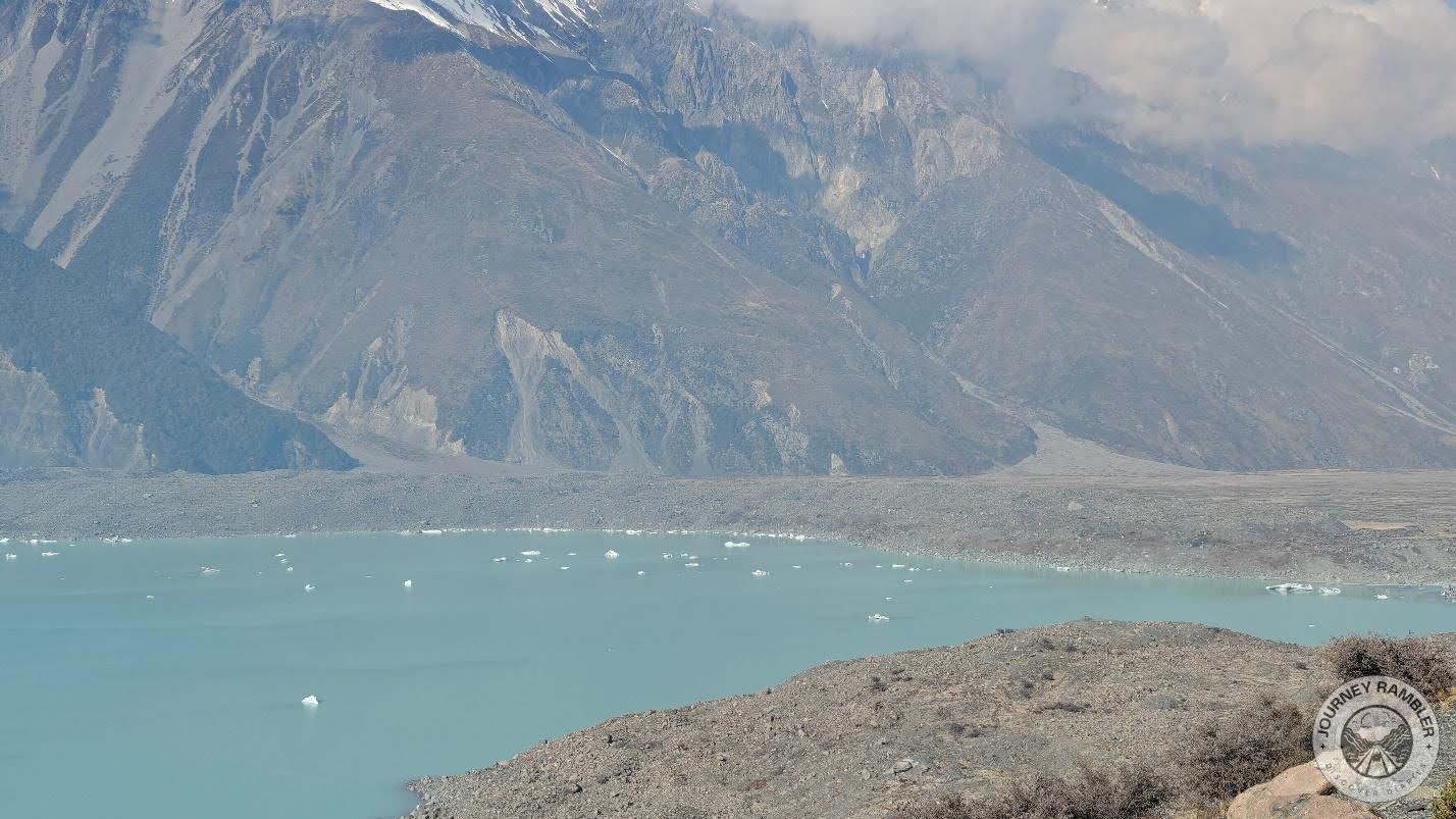
This is what the middle section of Tasman Lake looks like. I might be mistaken but I think the ice poking through the water’s surface is from the glacier. This ice probably got included in the glacial melt along with the moraine, which as explained in the Blue Lakes infographic, is what causes the turquoise/light bluish hue of the lake’s waters.
Here you’ll see a glimpse of the land south of Tasman Lake. This area was featured prominently in the first section of my Tasman Glacier Heli Hike article. If you want to see what it looks like from a helicopter then I’d suggest you seek that writeup out.
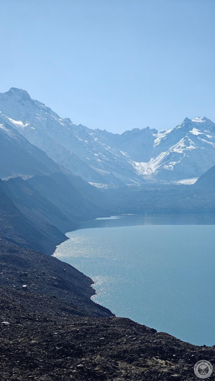
And this was one of the final images that I took of the Tasman Glacier View. At this point, I was feeling a little hungry from all the walking so I decided to head on back. The views and scenery here were absolutely stunning and I genuinely wanted to spend a little more time admiring them but unfortunately, my stomach was already complaining.
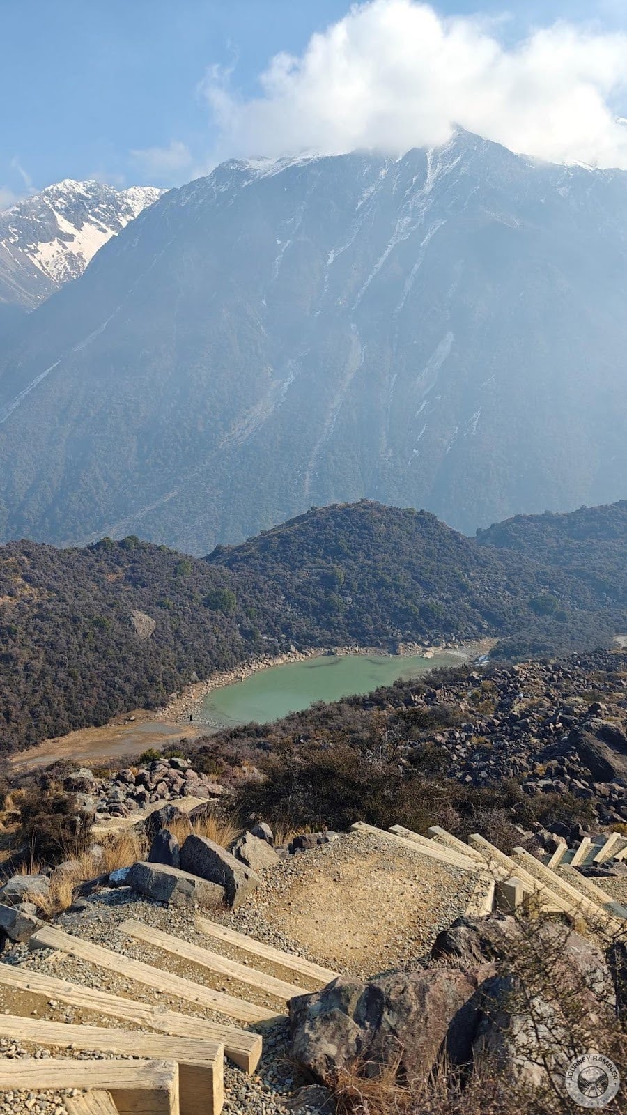
As I climbed down the stairs from the Tasman Glacier View area, I also got to see the Blue Lakes again. I don’t know why but this lake (which we visited earlier)looks much bigger from this vantage point for some reason. It’s not shown here but off to the right are other lakes (one is the smallest which you can see in the next image and the other is the largest which I unfortunately wasn’t able to picture) that can be accessed by following the path after crossing the lake in the image.
So with this my hike to the Blue Lakes and Tasman Glacier View ends. I thoroughly enjoyed this week and I think it would be a very inexpensive alternative to a Tasman Glacier Heli Hike. It’s not as exciting and definitely less scenic but it’s also free. Literally the only thing you’ll be paying for is your rental car or gas. More often than not, most operators also include this location in their packages. Overall, I think this is a great place to visit as it shows just how fearsome climate change can end up being.
What do you think about the Blue Lakes and Tasman Glacier View? Ever been to these locations in New Zealand’s South Island? If yes then make sure to share your experience with other readers by commenting!